
Category: Artificial Intelligence Department
On Wednesday, July 8, 2026, the Smart Community Mapping and Infrastructure Project at the Oba Civic Centre progressed to a crucial phase of practical assessment, strategic project mapping, and local historical grounding.
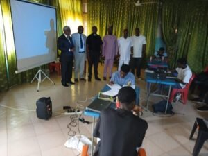
The day’s proceedings featured a highly insightful guest lecture by Reverend Chris Emelie (Ichie Akachukwu Global), who walked the trainees through the rich history, origin, demographics, and governance structures of Oba. This foundational context serves a major strategic purpose for the AI Department: providing students with deep historical clarity before beginning extensive site mapping.
Reflecting on the session, Reverend Emelie noted that introducing Artificial Intelligence into community mapping is a novel and exciting dimension—a perfect example of applying global technological tools to solve local infrastructure needs.
He challenged the trainees to embrace the challenge, stating that there is a vast amount of historical research work awaiting this “Gen Z generation” to uncover and integrate with modern data systems.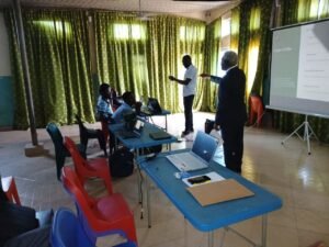
Community Support and Executive Vision
The event also enjoyed strong local backing, with the President General (PG) of Oba, Engineer Uzo Ejiofor (Ichie Idejimba), present to show solidarity. He expressed profound gratitude to the University for selecting Oba as the pilot community and encouraged the students to remain diligent, reminding them that they carry the hopes of both the community and the institution.
Speaking on the exact scope of the initiative, the Deputy Vice-Chancellor of the University on the Niger, Professor Christian Bolu, emphasized the practical and long-term impact of the exercise. Over the course of the 9-week Students Industrial Work Experience Scheme (SIWES) program, the scholars are tasked with an ambitious directive: to completely geo-reference the infrastructure of Oba.
This comprehensive data collection will map out critical community assets, including:
– Healthcare networks and local hospitals
– Educational institutions and schools
– Road infrastructure and essential utility grids (such as power and telecommunications networks)
– Key environmental priority areas, including active erosion sites
“We want to know about Oba first,” Professor Bolu shared, noting that the data gathered by the students will actively feed into long-term Smart City Planning for the region.
Measuring Competency and Rigor
Following the briefings, the focus shifted to academic accountability. Under the direction of the HOD of Artificial Intelligence, Reverend Canon Dr. Ifeanyichukwu Aniakor, the scholars participated in a series of comprehensive competency tests. These evaluations are meticulously structured to track the trainees’ understanding of spatial data capturing and their ability to successfully execute real-world field deployment.
The University on the Niger continues to blend high-level technological exposure with community-focused deployment, proving that these students are well on their way to becoming godly and competent professionals.
Stay tuned to this space as our scholars move from the lecture halls into active field mapping across the pilot sectors.